

MANY residents of Colchester often bemoan the pace at which the town is changing.
As the fastest growing settlement in the east, the town has rapidly expanded over recent years.
This means new retail and leisure developments are being built at a fast pace, as well as new housing estates.
We thought we'd take a trip down memory lane using photos from Google maps.
Looking at a few key spots in the town you can see how fast Colchester has changed, within the space of just a decade.
Take a scroll through our gallery below to see Colchester as you remember it.
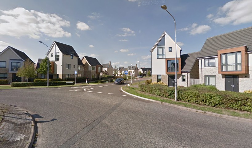
Circular Road North, April 2019
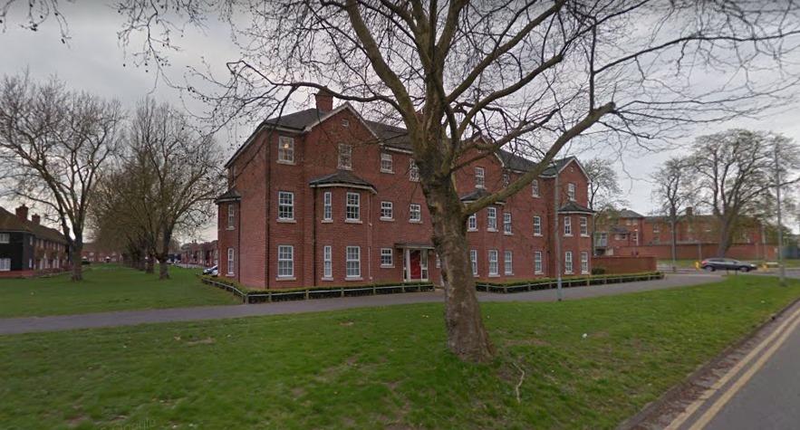
Google Maps images show how much Colchester has changed over the last decade
The area around Colchester Garrison has changed faster than most parts of Colchester.
With the size of the MOD's estate shrinking, new houses have sprung up regularly in the area.
This photo, from April 2019, shows some of the newest housing off Circular Road North, border Abbey Fields.
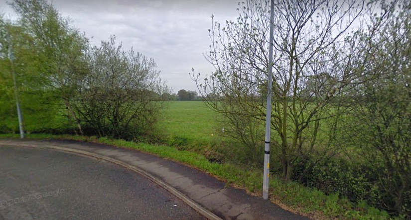
Circular Road North, April 2009
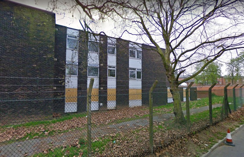
Google Maps images show how much Colchester has changed over the last decade
A decade earlier and this shot was taken in almost the exact same spot.
It shows an old military building where new flats now stand.
Junction 28 of the A12, October 2018
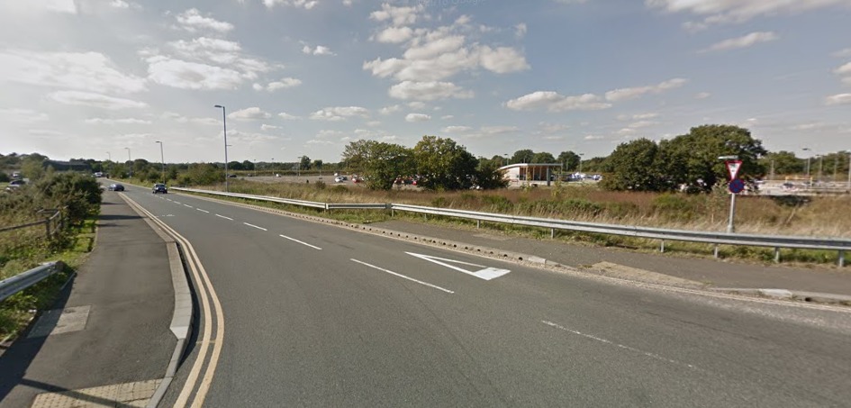
Google Maps images show how much Colchester has changed over the last decade
This Google image shows the junction, near Colchester United's Jobserve Community Stadium, virtually as it is today.
The Park and Ride and adjoining services, featuring a McDonald's as well as petrol station, are featured.
Junction 28 of the A12, October 2012
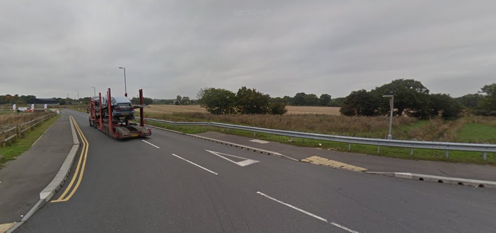
Google Maps images show how much Colchester has changed over the last decade
Just six years earlier and there's no sign of the Park and Ride.
There have also been further developments to the service station since 2012.
Mill Road, September 2018
Google Maps images show how much Colchester has changed over the last decade
Highwoods and the north of Colchester hasn't been able to avoid development over recent years.
This image, from September 2018, shows the estate around Olympic Boulevard in all its glory.
Mill Road, April 2009
Google Maps images show how much Colchester has changed over the last decade
Rewind almost a decade to April 2009 and there is no sign of the new estate at all.
Off the roundabout where Mill Road meets Brinkley Lane, there is just fields where the estate now sits.
Read more:
- Latest on £60m Stane Retail Park development featuring Aldi, M&S and B&Q
- First look at new Colchester restaurant Kintsu from Grain owner
- New pupil referral unit set to be built in Colchester
Berechurch Hall Road, April 2019
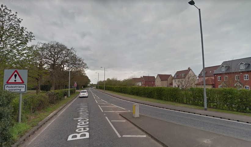
Google Maps images show how much Colchester has changed over the last decade
Monkwick has also grown rapidly over recent years.
This photo from 2019 shows the Hooper Avenue estate as it is pretty much today.
Berechurch Hall Road, April 2009
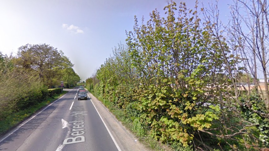
Google Maps images show how much Colchester has changed over the last decade
Look at the same spot a decade earlier, however, and you'll see pretty much no sign of the new homes.
You can also tell changes have been made to Berechurch Hall Road itself to accommodate the new residents and their cars.
Magdalen Street, November 2020
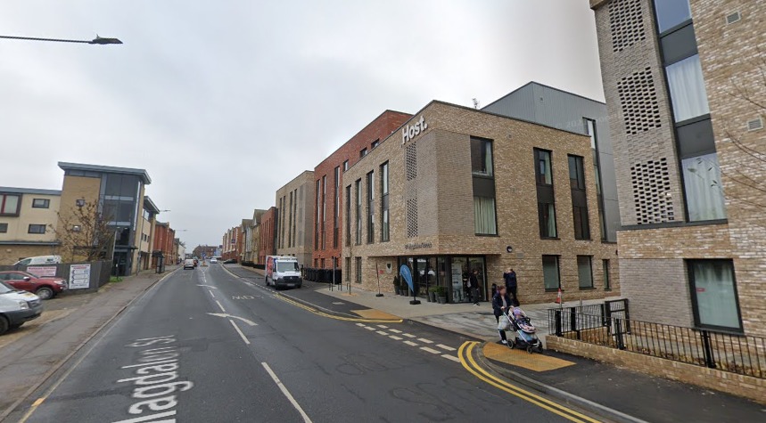
Google Maps images show how much Colchester has changed over the last decade
Magdalen Street, near Colchester town centre, has changed significantly.
This photo shows Host's new student flats development as it is today.
The £23 million scheme finished last year and provides space for more than 250 students to live off the University of Essex campus.
Magdalen Street, April 2009
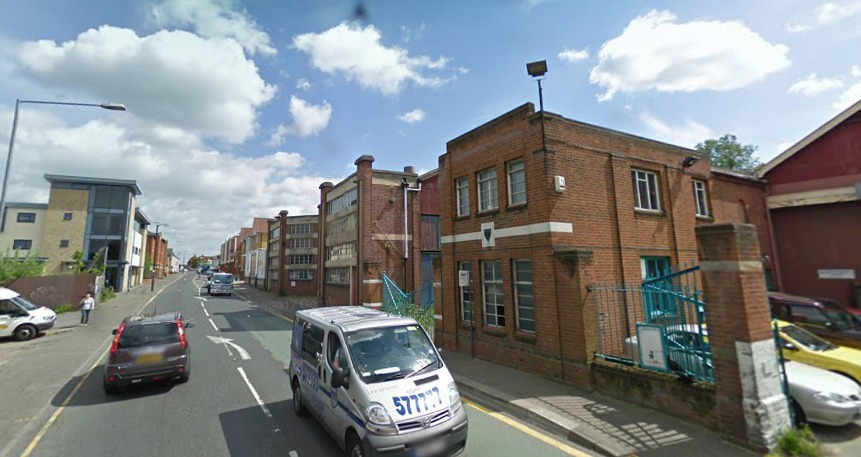
Google Maps images show how much Colchester has changed over the last decade
The same site a decade earlier was still home the town's old bus depot.
It looks completely different a decade down the line.
Have old photos of Colchester you'd like to share?
Send them to robbie.bryson@newsquest.co.uk.
You can also see more of our Google Maps pictures showing how Colchester has changed here.


Comments: Our rules
We want our comments to be a lively and valuable part of our community - a place where readers can debate and engage with the most important local issues. The ability to comment on our stories is a privilege, not a right, however, and that privilege may be withdrawn if it is abused or misused.
Please report any comments that break our rules.
Read the rules hereLast Updated:
Report this comment Cancel