

ESSEX could be hit by barrage of snow this weekend, forecasters have warned.
The Met Office has issued a yellow weather warning for Saturday, Sunday and Monday.
It says there will be cold conditions through the weekend and into the following week with some disruption from snow and ice possible.
The warning is in place for north Essex from 3pm on Saturday until the end of Monday.
An amber warning is also in place across Essex on Sunday, between 4am and midnight.
Conditions will be very cold and residents are being told to check on their neighbours to ensure they are coping with the conditions.
The Met Office said on Friday: "This weather could increase the health risks to vulnerable patients and disrupt the delivery of services.
"Although temperatures will be slightly milder today, it will become much colder over the weekend with a strong easterly wind flow developing during Saturday in the north, reaching the south Saturday night, with wintry showers in eastern and northern counties.
"This will likely lead to icy conditions on roads and risk of travel disruption.
"There is an increasing risk of significant snowfall in the far southeast and East Anglia as well Saturday night into Sunday.
"Very cold temperatures will spread to all parts of the country by the end of Sunday and into Monday morning - the coldest period of the winter so far. Indications are that all parts of England are going into a notable cold spell of weather as we head into the coming week with sharp overnight frosts, and temperatures near freezing by day, together with cold winds."
Read more:
- Colchester: Yellow weather warning for snow this weekend
- Essex weather: Wxcharts reveals when snow may fall on Sunday
- Essex weather: Arctic blast set to hit county this weekend
- Essex weather: Met Office upgrades snow warning to amber
But when could north and mid Essex see snow this weekend?
Here is what the forecasters are saying:
Colchester
Colchester will likely see a very wet Saturday, with conditions turning colder into the evening.
There is a chance of some sleet from 9pm and overnight.
Sunday could see snow, however, with some heavy showers even being predicted in the early hours of the morning.
The snowfall is likely to continue throughout Sunday and Monday.
Clacton
The seaside town will see some rain showers on Saturday, but is likely to avoid the worst of the wet conditions.
However on Sunday, from around 3am, snow could arrive in the area.
Again it is predicted to continue throughout the day and into Monday, with temperatures dropping as low as 0c.
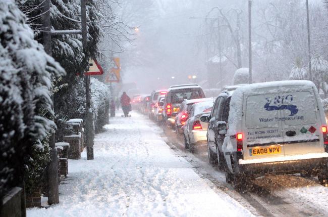
Snow could arrive in north and mid Essex this weekend
Harwich
Forecasters are predicting a wet Saturday in Harwich with the rain turning to sleet overnight.
It is likely to see some snow, including heavy showers, on Sunday morning and throughout the day.
Monday will also bring further snow, with temperatures dropping to 0c.
Braintree
Braintree could see snow earlier than many other areas, with the white stuff expected to arrive at about 9pm on Saturday.
The snow will continue to fall through the night and across Sunday.
Monday will remain cold with a risk of further snow until the late morning.
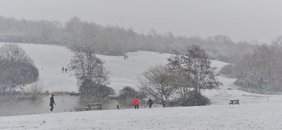
Winter's tale - Shiela Winwright took this beautiful picture of the snow in High Woods Country Park
Halstead
In Halstead sleet could start falling on Sunday night, with snow expected throughout Sunday and Monday.
Temperatures will drop to 0c.
Maldon
Maldon is set to be wet on Saturday, with warmer temperatures than much of the area.
But on Sunday snow is expected to arrive in the district, remaining with us until Monday afternoon.


Comments: Our rules
We want our comments to be a lively and valuable part of our community - a place where readers can debate and engage with the most important local issues. The ability to comment on our stories is a privilege, not a right, however, and that privilege may be withdrawn if it is abused or misused.
Please report any comments that break our rules.
Read the rules hereLast Updated:
Report this comment Cancel